$ cat geovoice.json
title: GeoVoice
category: web
client: POWER Engineers
date: Jan 10, 2021
stack:Geospatial MappingUX/UI DesignData VisualizationCollaborative Tools


Project Overview
GeoVoice is a platform created to streamline geospatial data analysis and stakeholder feedback, primarily for large-scale infrastructure and environmental planning projects. By integrating intuitive mapping tools with a centralized feedback system, GeoVoice enables teams to gather, visualize, and act on geographically specific insights in real time. The result is a more transparent and efficient way to collaborate, whether for urban development, energy planning, or environmental impact assessments.
Situation
• Overview
Large-scale projects often involve multiple stakeholders—community members, government agencies, and private sector partners—who need to provide location-specific feedback. Existing processes (e.g., in-person forums, paper surveys) can be slow, fragmented, and prone to data loss.
• Challenge
How might we simplify the process of collecting and analyzing spatially relevant feedback to make more informed decisions?
• Context
Advances in geospatial technology offered new possibilities for data visualization, but most tools weren't user-friendly or collaborative enough for diverse, non-technical audiences.
Task
• Consolidates
multiple map layers and real-time data inputs.
• Facilitates
stakeholder engagement through an easy-to-use interface for comments and feedback.
• Empowers
project teams to make quicker, more accurate decisions using interactive mapping and clear data visualization.
Action
1. Research & Alignment
Conducted sessions with local planners, environmental experts, and community members to pinpoint their biggest pain points in collecting and sharing geographic feedback. Evaluated existing GIS tools and collaboration platforms, identifying gaps in usability and real-time interaction.
2. Rapid Prototyping
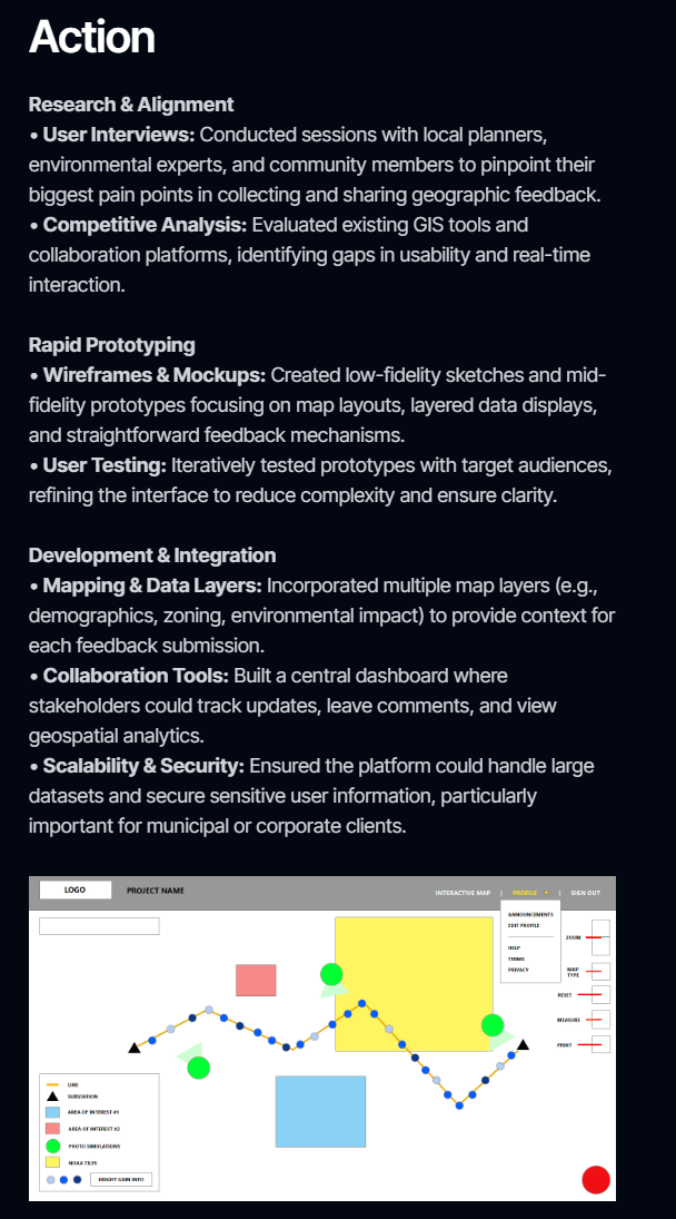
Created low-fidelity sketches and mid-fidelity prototypes focusing on map layouts, layered data displays, and straightforward feedback mechanisms. Iteratively tested prototypes with target audiences, refining the interface to reduce complexity and ensure clarity.
3. Development & Integration
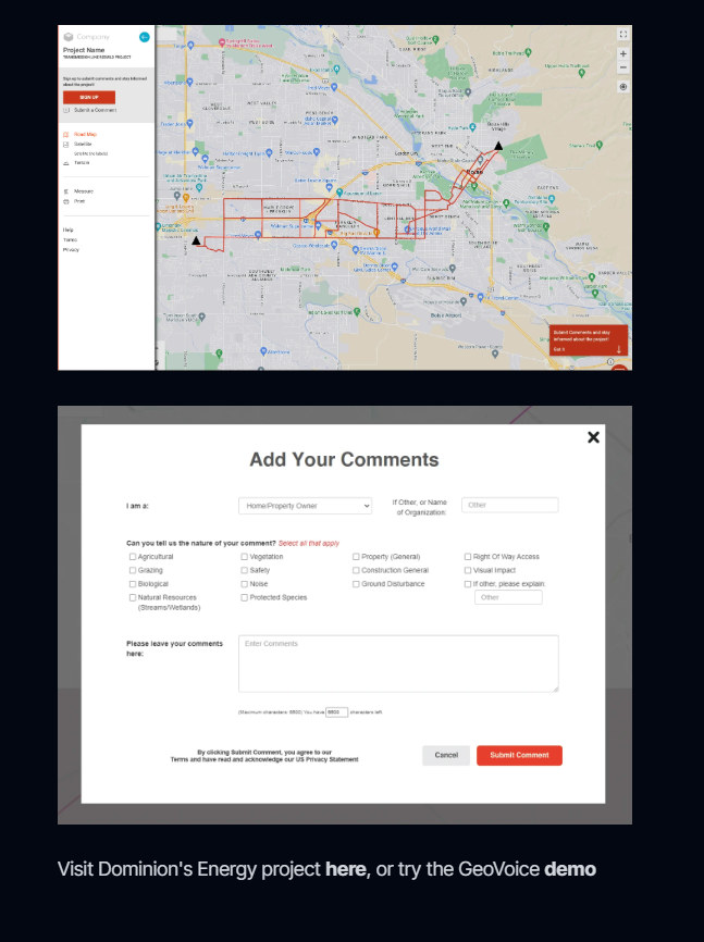
Incorporated multiple map layers (e.g., demographics, zoning, environmental impact) to provide context for each feedback submission. Built a central dashboard where stakeholders could track updates, leave comments, and view geospatial analytics. Ensured the platform could handle large datasets and secure sensitive user information, particularly important for municipal or corporate clients.
Result
• Enhanced Collaboration
A centralized environment allowed diverse stakeholders to contribute geospatial insights, reducing silos.
• Faster Feedback Loops
Real-time data updates and straightforward comment submissions cut weeks off traditional planning cycles.
• Broader Applicability
The modular design supported expansion across multiple regions and project types, from infrastructure upgrades to environmental monitoring.